


tour Amblie

vienne14400
User
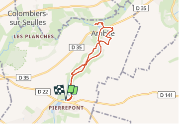

Length
6.6 km

Max alt
31 m

Uphill gradient
69 m
Km-Effort
7.5 km

Min alt
4 m

Downhill gradient
67 m
Boucle
Yes
Creation date :
2025-05-01 12:39:08.106
Updated on :
2025-05-01 14:26:46.766
1h46
Difficulty : Medium

FREE GPS app for hiking
 SityTrail
IGN / Geographical institutes
SityTrail Plus
The world is yours!
About
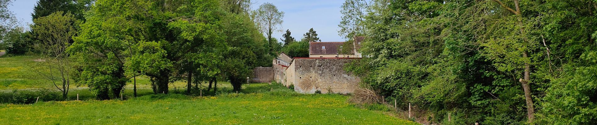
Trail Walking of 6.6 km to be discovered at Normandy, Calvados, Ponts sur Seulles. This trail is proposed by vienne14400.
Photos

Positioning
Country:
France
Region :
Normandy
Department/Province :
Calvados
Municipality :
Ponts sur Seulles
Location:
Unknown
Start:(Dec)
Start:(UTM)
681680 ; 5461119 (30U) N.
Comments